This October, we are organising a series of days to learn about the medieval history of our region. Specifically, we will visit some villages that built walls upon the arrival of James I in the 13th century and were consolidated as new Christian towns. This is very interesting because sometimes we are not aware of all the vestiges we have in our villages from this stage of history which, after so many centuries, are still part of our urban layout.
A LITTLE HISTORY. We know where we come from to decide where we are going.
From the mid-12th century, the Catalan-Aragonese crown was undergoing a process of territorial expansion over the eastern part of the Iberian Peninsula. However, it was not until the mid-13th century that they arrived in our region, with King James I. Between 1244 and 1245 the Muslim cities of Dénia and Xàbia and their territories of influence were conquered. After this, Christian settlers from the north were supposed to come to occupy the lands, but it was a very slow process. Between 1245 and 1270, there can hardly be said to have been any Christian repopulation, and the population was still predominantly Muslim. During these years, there were numerous Muslim rebellions against the Christians. Particularly notable were those of Al-Azraq, who for a time controlled the inland area of the Marina Alta until he was finally defeated.
With the conquest the territorial and political organisation changed, and a new feudal system was introduced. The mechanism by which Christian colonists were settled was the granting of letters of settlement drawn up by order of the king or the lord proprietor of the territory. These were grants for the establishment of land and houses in favour of the peasant families who went to live there. A series of rights and duties for these resettlers was also established. This distribution was carried out at the expense of the forced and violent expropriation of its former inhabitants. With these letters of settlement, various villages were founded throughout the 12th and 14th centuries, which were fortified to defend against attacks by North African pirates or Muslim raids. The walled enclosures evolved over time. From the 13th to the 15th centuries, smaller and more primitive enclosures were found, and from the 15th century onwards they expanded and were modernised, as the previous ones had become obsolete with the advent of firearms. Some have become present-day cities and towns, such as Dénia, Xàbia, Pego, Teulada and Benissa. Others have disappeared, such as the Pobla d'Ifac. These are the towns we will visit in search of the walls that surrounded these villages.
Tips for the routes
- Wear comfortable footwear and bring water.
- Respect nature and the architectural remains.
- For more information, consult the tourist information offices.
SUGGESTED JOURNEYS. Step by step, we make our way.
Pego
Stage 1: The Pego Wall
Before the arrival of the Christians, the Pego area was home to several farmsteads. A farmstead was a cluster of houses inhabited by free peasant farmers who owned their own land. It was the smallest unit of the castral district in al-Andalus. We have documentation of the existence of the following: Castelló, Benigani, Beniayahet, Unxola, Benumeia, Atzeneta, Favara, Benituba, Rupais, Benisuleima and Cotes. The town of Pego was built on the alqueria of Unxola, which was the closest to the spring. No material remains of this alqueria survive. In 1279 the first charter of population for the town of Pego was granted, but it proved insufficient, as not many repopulators had settled and there was still a large Andalusian population. For this reason, in 1286, a new charter of population complemented the previous one. From that moment on, the town began to be built, with a wall surrounding it. The wall opened onto three gates: the Mayorazgo Gate, the Raval Gate and the Sala Portalet, which can still be seen today.
We will begin this first route at the entrance to Ecce Homo Street from Captain Cendra Street. At this point stood the Mayorazgo portal, which was still standing at the beginning of the last century. However, it was demolished as part of the town's modernisation and improved communications. However, if we look up, we can still see some remains. On the inner side of the wall, above the gate, there was a religious altarpiece which, fortunately, is still preserved. To see it, we will have to enter the Llorca Pharmacy, where it is on display.
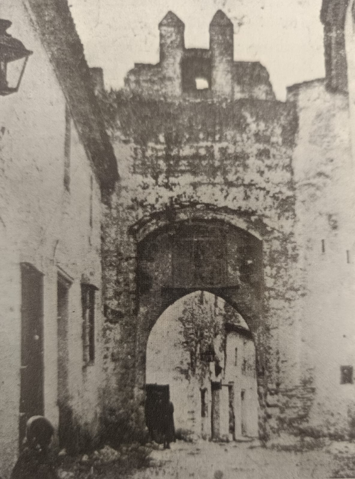 View of the gate from inside the rampart.
The photograph shows the Portal of the Mayorazgo at the beginning of the 20th century. Above the arch can be seen a very blurred square corresponding to the religious altarpiece we have mentioned. Currently, we can only observe the following remains:
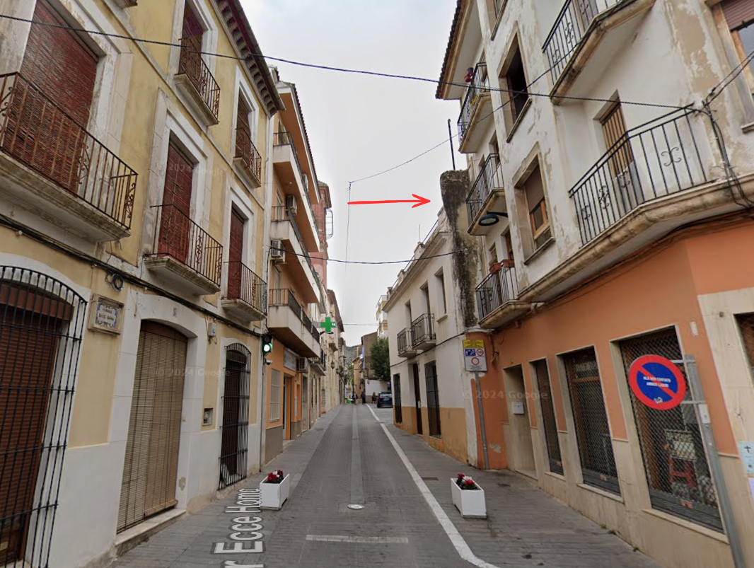 View of the site of the gate from the outside of the walled enclosure.
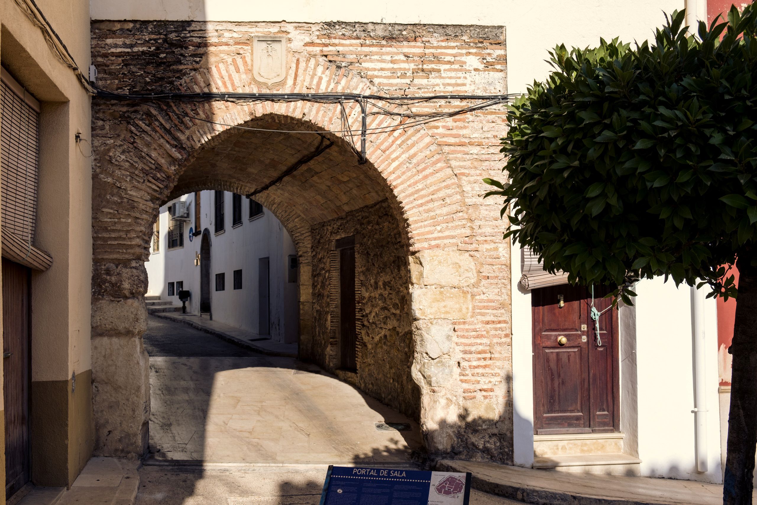
From this entrance to the town, we will try to picture in our minds where the rampart ran and spot some of its remains. Before we begin, it should be borne in mind that the rampart has been incorporated into the houses and is virtually invisible. Why? Because there were houses within the walls built right up against the rampart, and outside, where the defensive moat had originally been, more dwellings were later built against the wall as well. Consequently, the walls lie between buildings at many points around the town. This is why if you go along Sant Cristòfol Street you can enter the La Muralla shop and, at the back, the walled section is on view. We'll go down Sant Jaume Street and won't see anything until we reach the Portal de Sala, but bear in mind that the wall is behind the houses on our left. We will enter through the gate, the only one that remains, the smallest of the three. Beside it there are also remains of a tower. We will pass the House of Culture and we recommend you enter its courtyard, as the wall at the back is also part of the rampart. From here we will walk towards the church. In the area of the current church's apse, the butchers' shops were located centuries ago. We will arrive at the Town Hall square, where the third entrance gate to the town of Pego used to be. We'll take Vallet Street, which runs under the arches of the Town Hall, and when we reach Saint Louis Street we'll turn left. On reaching Mestre Blasco Street, we should look up at number 12 for the remains of high walls and a tower. We'll need to step slightly onto the other side of the street to see them. It would also be interesting to visit the Ecce Homo Chapel.
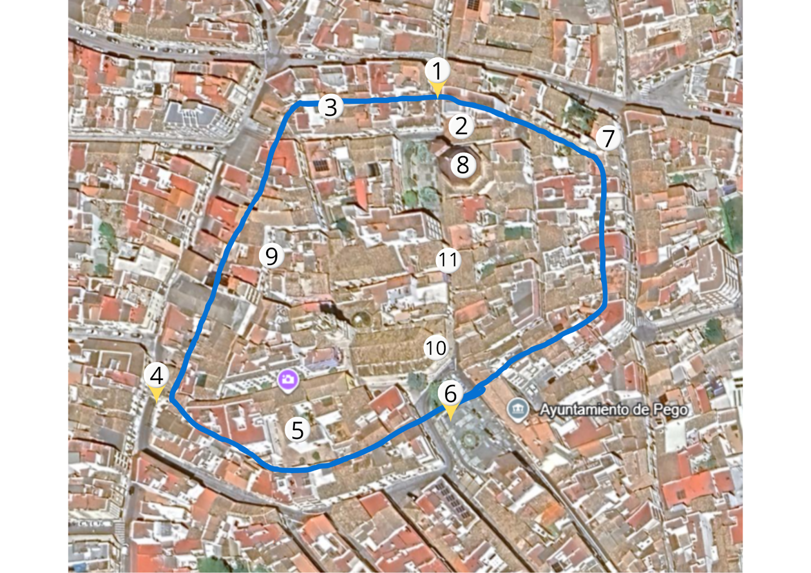
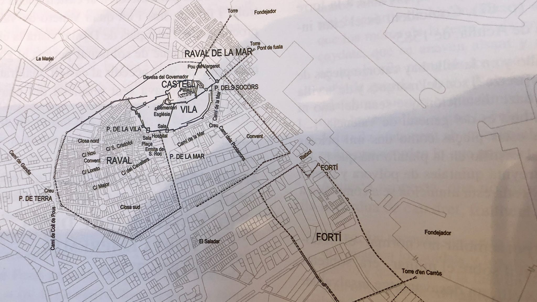
On the following map you will find the course of the rampart and the locations of the points of interest.
1 Mayorazgo Gate.
2 Pharmacy with altarpiece.
3 La Muralla shop.
4 Sala Gate.
5 Courtyard of the House of Culture.
6 Portal del Raval.
7 Walls and tower behind house number 12 of Mestre Blasco.
8 Ecce Homo Chapel.
9 Bakery and tavern.
10 Butcher's shop.
11 Former High Street.
Denia
Stage 2: Denia Castle
In 1244, with the arrival of James I, Denia was incorporated into the Christian Kingdom of Valencia. In 1304, James II forced the population to move inside the castle's walled enclosure, as there was a danger of attacks by Barbary pirates. Denia Castle is one of the most outstanding fortifications in the region. It features the typical structure of the most advanced Muslim castles, with three partially concentric enclosures: the alcazaba at the highest point, the albacar in the middle, the ravals and the fortified outpost. This complex fortified protection is due to the importance of the city of Dénia as the capital of the Taifa kingdom of Denia. Today, the castle retains this structure, with the addition of towers and walls from the medieval Christian period.
Once we enter the castle complex, we are on what was, in the time of James II, the Old Town of Dénia. This is a new town laid out from scratch which, due to the nature of the terrain, does not conform to the urban planning parameters of new settlements from the 13th and 14th centuries. After several reforms, it was demolished in 1713 as part of the urban reform policies carried out by the new Bourbon administration, which converted the castle into the town's military governor's residence.
If we climb the path to the Old Town we will find the Baluard, an 18th-century building, and the marks of the projectiles from the various wars that have ravaged Dénia in recent times. From the bastion, through a horseshoe-shaped gate, we enter the highest part of the castle, where we find the Governor's Palace, a former 14th-century palace that has been renovated several times, most recently by the Marquis of Denia to accommodate Philip III when he was in the city. Currently, the Governor's Palace houses the Archaeological Museum, where we can see many of the archaeological finds resulting from the work of archaeologists in recent years. Descending along the path of the Old Town, we will pass the Council Tower, which from 1621 was home to the Town Hall and, later, in the 20th century, the city's first archaeological museum. Having seen the castle, we descend via Sant Francesc Street and the Cid Avenue to the Murallas Roundabout, where there are restored remains of the city's first walled enclosure.
Next to the castle is the walled town we mentioned earlier. These are the city's oldest walls. Later, the walls of the Ronda Muralles were built, encircling the quarter. Part of this layout can still be seen, as walls and towers have been restored.

Xàbia
Stage 3: The Walls of Xàbia
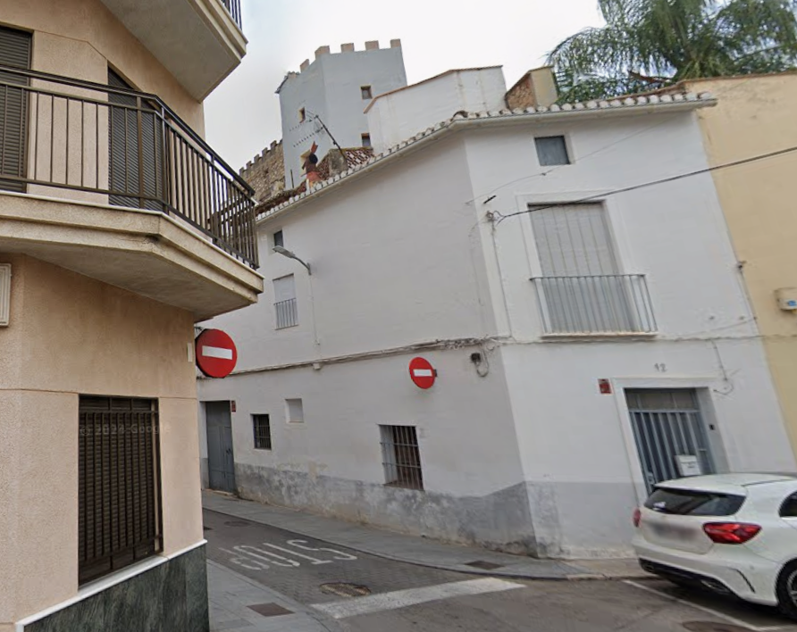
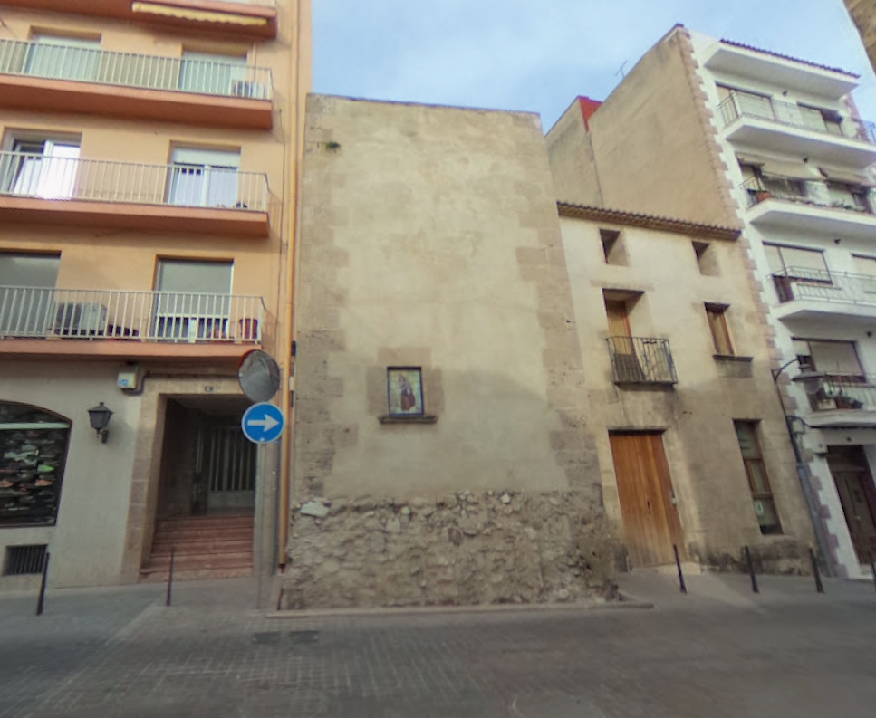
In the Middle Ages, Xàbia was a small enclosed settlement with a 13th-century wall, complete with corner towers. One was probably the Cairat tower, which can still be seen. The founding of the fortified town of Xàbia dates back to the early 14th century, built over the pre-existing Muslim enclosure that ran along the streets of Roques and del Pilar. In 1307 James II ordered the inhabitants of Xàbia to build a fortress with a moat, thereby incorporating the earlier walls and enclosing the old square-plan rampart around the church. By the 15th century there had been a major urban development owing to population growth. For this reason, in the 16th century the perimeter of the walls was modified so that the town was surrounded by the South Rampart, North Rampart, Prince of Asturias Street and Columbus Rampart. There were four gates: the Ferreria Gate, the Clot Gate, the Sea Gate and the New Gate, which dates from later. Around the church of Sant Bartomeu lay the oldest part of the town, where fifteenth-century Gothic houses can still be found. The New Gate was opened in 1805 and was located near the present-day Plaza de la Marina Alta. Between 1869 and 1874 the walls were definitively demolished and avenues necessary for trade were created, connecting the Plaza del Convent and the port. For this reason, the wall is practically gone. Only the foundations of some reconstructed walls on Avenida del Príncipe de Asturias remain, a possible stretch of wall on Calle Muret and a possible tower, as we have already mentioned, on Calle Rocas.
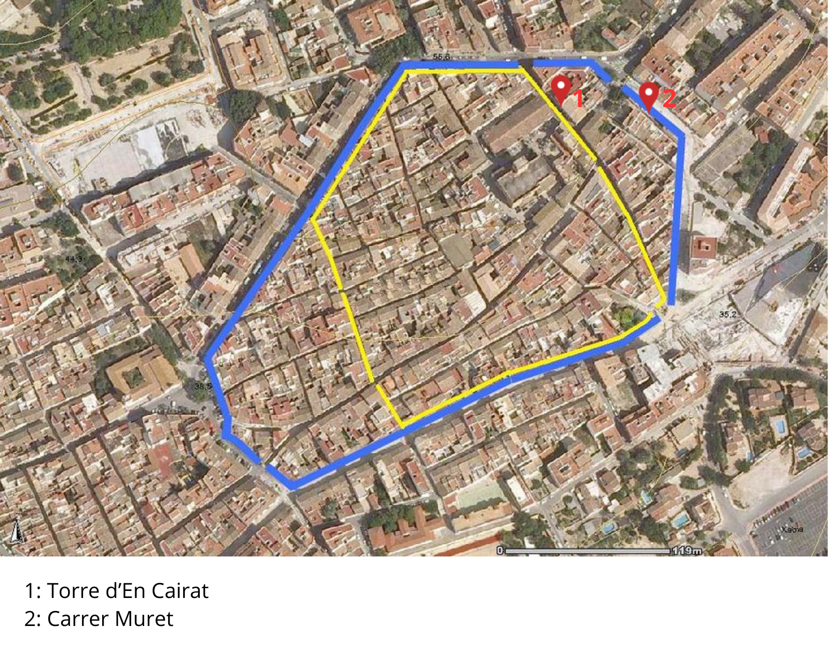
The yellow lines represent the most primitive wall, built on the old Muslim enclosure. The Torre d'En Cairat, marked in the image next to the Municipal Market, dates from this period. Later, it had to be expanded and the one we see marked in blue was built. On this, we have marked the location of a possible part of the wall that gives its name to Muret Street. We can also see the openings corresponding to the site of a gate.
Calp
Stage 4: The settlement of Ifac and the town wall of Calp
In Calp, we find two walled settlements. The Pobla d'Ifac was the first of these, located on the Ifac rock. This was a new foundation, not built on any pre-existing Andalusian settlement. It consisted of a long walled perimeter with over a thousand linear metres preserved on its north, east and west fronts. To the south, the rock acted as a natural barrier.
This medieval settlement is notable for being the only site of its kind in the Valencian Community that has not previously been investigated, excavated or altered. It is an urban area from the late 13th century, promoted by the admiral Roger de Llúria, one of the most important figures of his time. It is an enormous walled enclosure equipped with a complex system of access, rooms, warehouses, houses and an imposing church dedicated to Our Lady of the Angels, with a medieval necropolis at its foot. It is a short-lived building, no more than a hundred years old. Historical events forced the abandonment and relocation of the colonists from Ifac to the mountain where the walls and the old town of Calp are now centred.
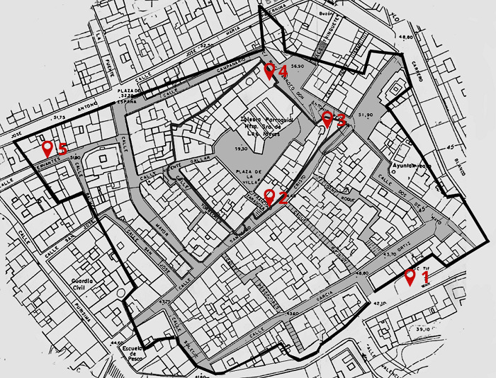
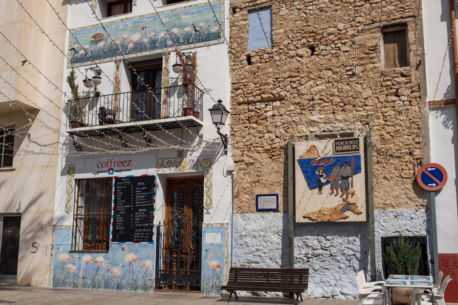
In the old town, a first wall was built around the church, where the first settlement of Calp was located. A second wall was then built, enclosing the previous one and the suburbs, with bastions. We will start the route from Mariners' Square (1), where a part of the wall that surrounded the town can be found. There is also a statue in honour of the sailors, as fishing is one of Calp's most characteristic activities.
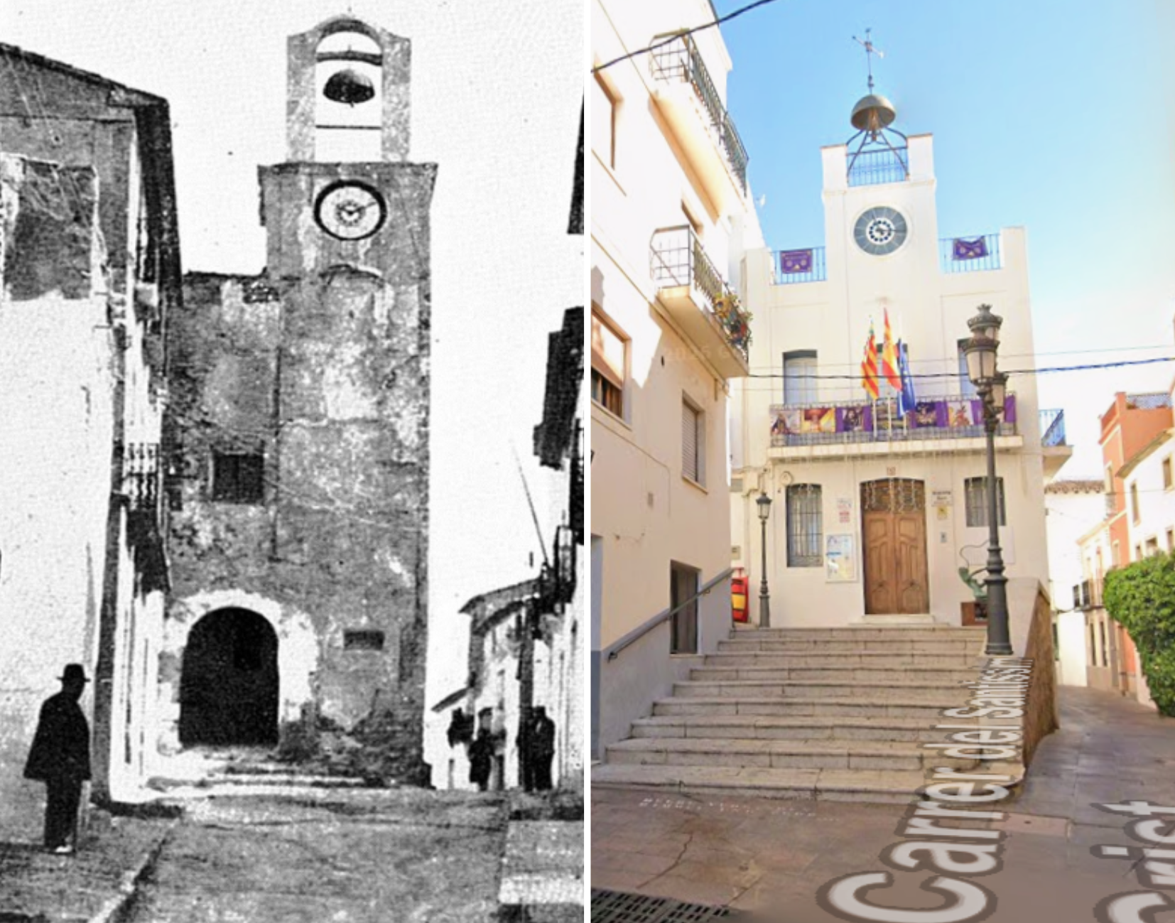
At the junction with Puchalt Street stood the Portal de la Mar. We'll head down this street until we reach the junction with Santíssim Crist, and on our left we'll find the entrance to the oldest wall that protected the town. Today, this is the site of the Old Town Hall Exhibition Hall (2), which stands on the site of one of the historic gates of the old walled enclosure, popularly known as ‘el Portalet’. a defensive gate that enclosed the Church Square as a citadel and last bastion, in the event the enemy breached the first wall. Demolished in 1923, a building (the one we see today) was erected in its place, which between 1926 and 1974 served as the Town Hall and judicial offices; and from 1996, until its relocation in 2013, it housed the municipal Archaeological Museum.
We will climb the steps up to the Town Square where, in the distance, we will see an arch and some restored walls that belonged to the rampart (3). On the right we will find the Peça keep and on the left the old church (4), which, being fortified, is also integrated as part of the rampart.
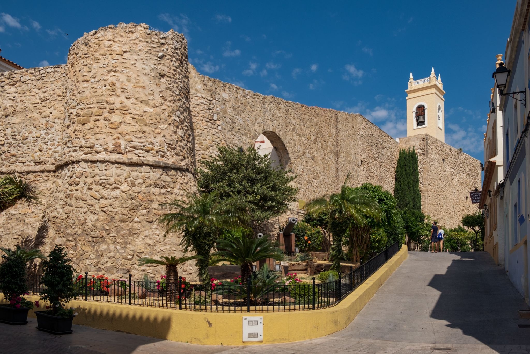
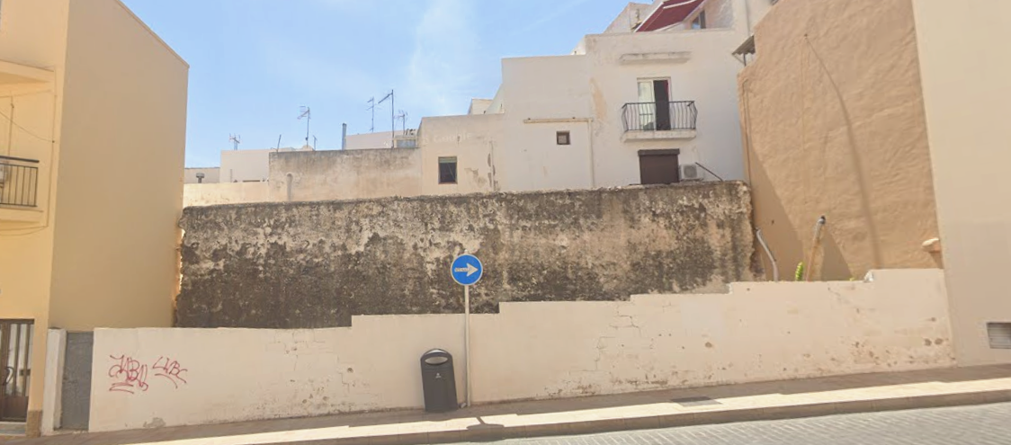
Finally, we'll continue strolling through Calp's old town, enjoying the charm of the streets, the shops and the bars and cafés. If we pass along Cervantes Street (5), we can see another section of the rampart.
Teulada
Stage 5: The Fort and Walls of Teulada
The Christian village of Teulada was established on a previous Muslim settlement, as explained in the Book of the Partition. Thus the new feudal order began. The first walled enclosure was built before the 15th century. It was a fortified enclosure that surrounded the church and its nearest streets (shown in black on the map). A second enclosure was built around the first fortified area in the 16th century, corresponding to the red lines, and was expanded in the 18th century to form the blue area. If we compare this plan with present-day Teulada, we can see that it retains the shape of the walls.
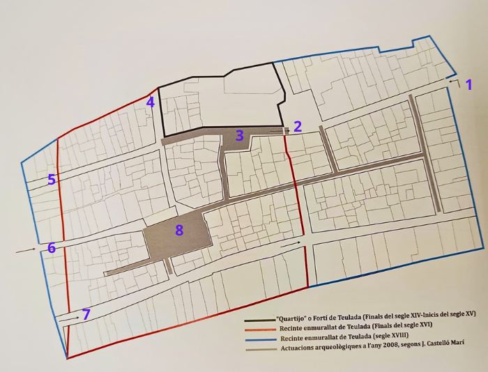
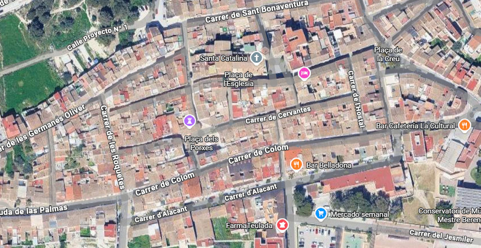
For example, on Roquetes Street, at its far left, we see a wall descending, represented in blue – that is, the later one – but not far away ran an older wall. Of that older wall, few material remains remain, but you can make out the line along which it ran.
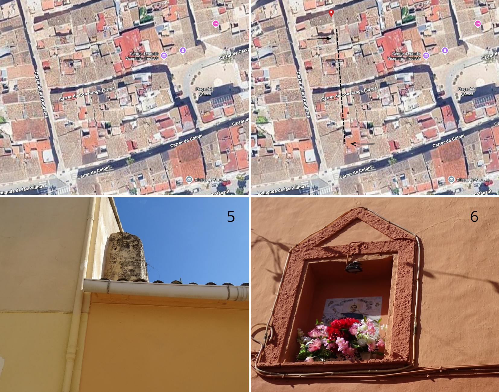
That said, we will begin the tour at the Cross Square, where there was a gate leading into the enclosure (1).
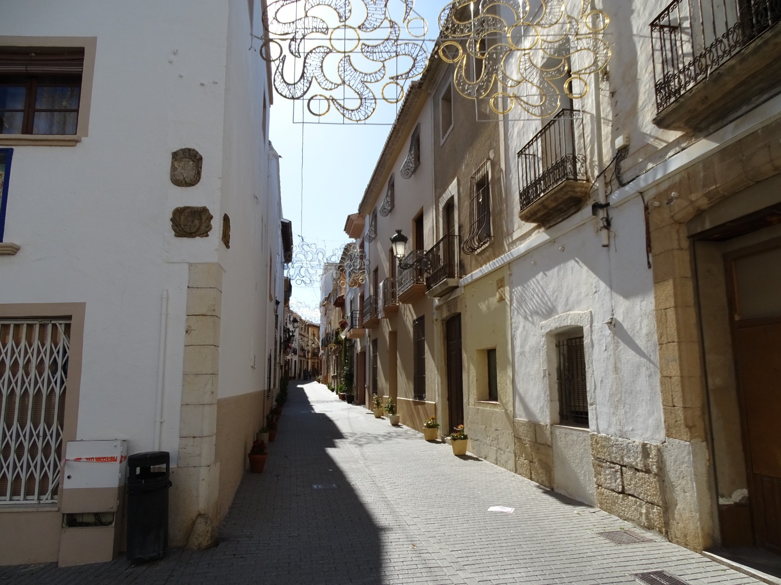
No traces of the gate remain, but there are some 18th-century stone shields. We will walk towards Plaza d'Espanya and reach the church. It was surrounded by the fort, of which traces still remain. Between the church and the Casa Abadia there was another gate: the Barbacana Gate (2).
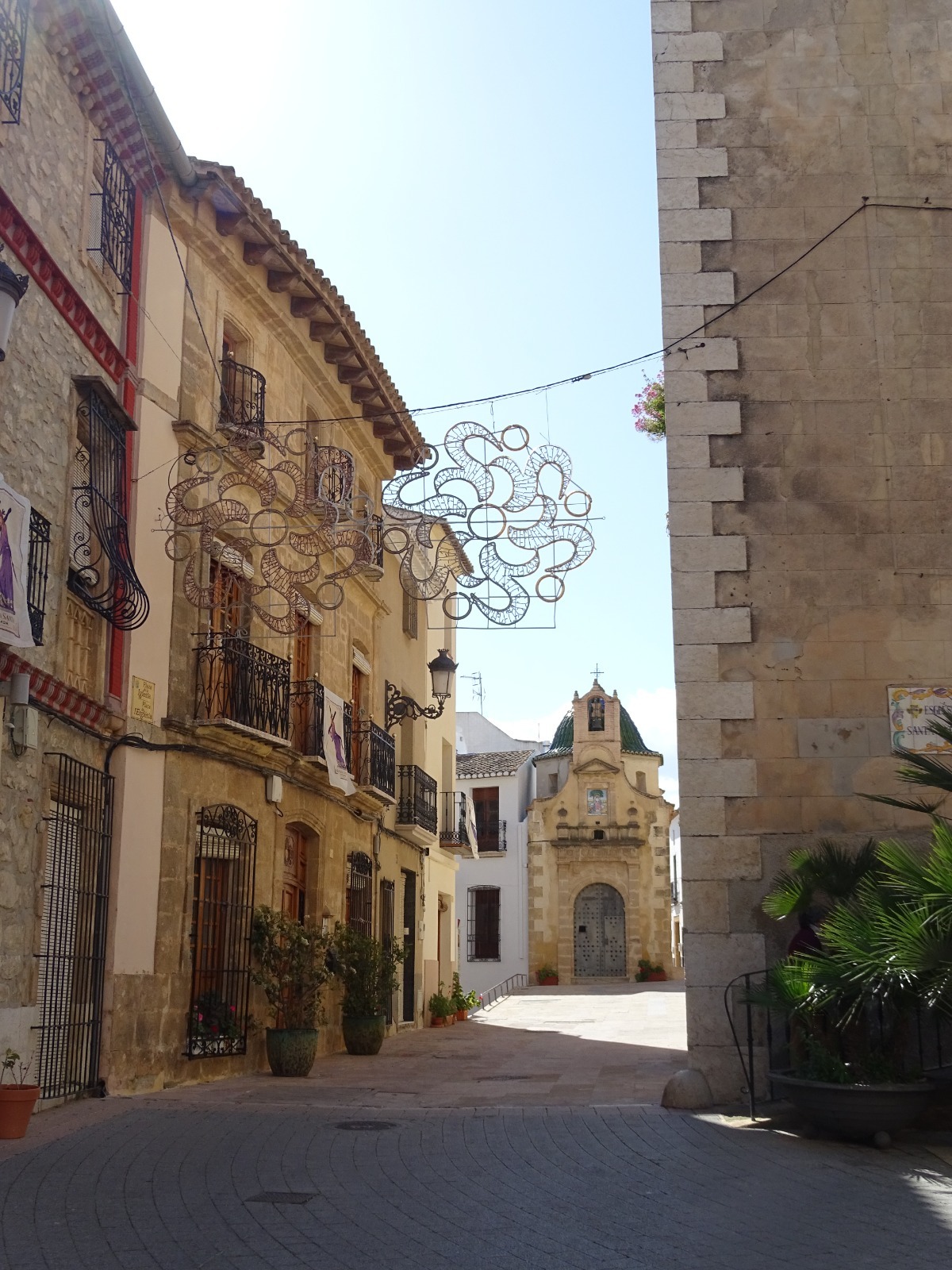
Number 3 on the map indicates the remains of the fortification that surrounded the church and can be seen in the following image.
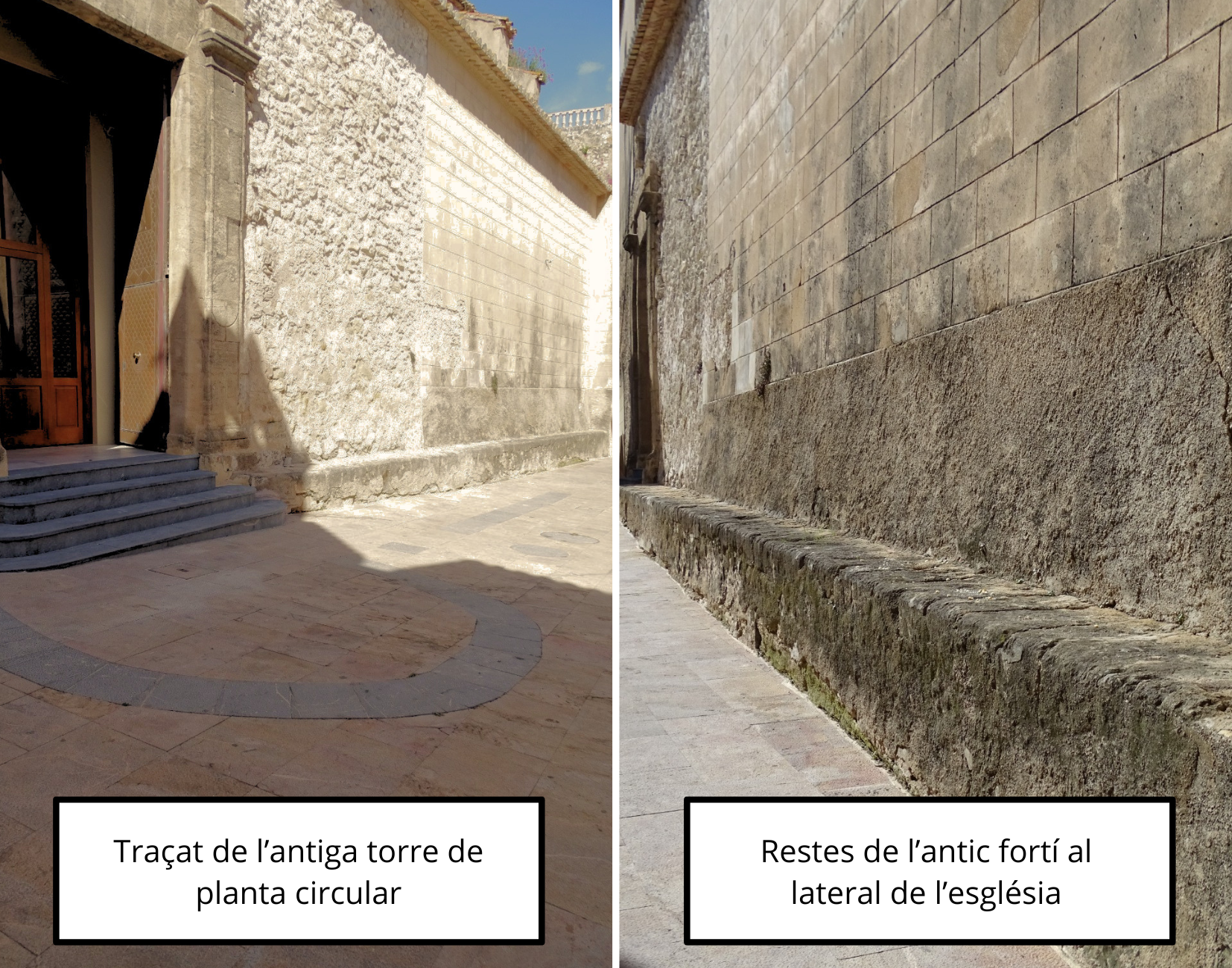
We can see remains of the fortification that surrounded the church. In addition, a marked burial site with paving stones reveals the silhouette of a now-vanished circular-plan tower. There are also remains of Arab-origin cisterns excavated underground. From here we will move to number 4 on the map, at the start of the Sisters Oliver Street, and see this:
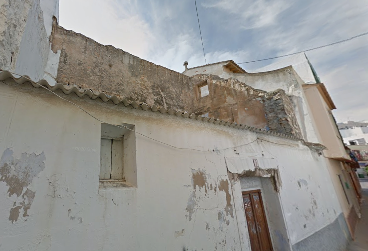
It also corresponds to a fragment of the church fortification. You can see the bell tower in the background. Now we will look for Doctor Moll Street, where we will find remains on the upper floor of a dwelling (5). Further up you will find an image of these. At the entrance to Constança Ferrer Street from Roquetes Street, on the façade to our left, we will see a niche of Vicent Ferrer (6). This was where another access to the ramparts, the Portalet, was located, and this niche was situated above the entrance arch on the inside.
If we continue down Roquetes Street, at the junction with Colom Street was the Portal d'Avall (7). We recommend you take a stroll through these streets and, if you go to the Pòrxens Square (8), you will see the house that belonged to Constança Ferrer, sister of Vicent Ferrer, a 14th-century plan of Teulada and an old gaol.
Benissa
Stage 6: The Walls of Benissa
In the case of Benissa, there is less documentation regarding its origins. The Book of the Repartition places its foundation in 1248 on an Islamic farmstead. However, only a couple of cisterns have been found that could prove its existence. It was not until 1381 that a document was found confirming the creation of a Christian settlement in the area, at which point a wall was built in response to a demographic increase. This demographic increase was the result of the sack that led to the destruction of the town of Ifac. Its inhabitants dispersed to the nearest towns.
Benissa was fortified in 1382, with the Major Street as its main axis and two entrances to the enclosure, one at each end. In the 16th century the town expanded significantly and there arose a need to build more walls, towers, religious buildings, civic buildings and homes for the local elite, for example the Batlle houses.
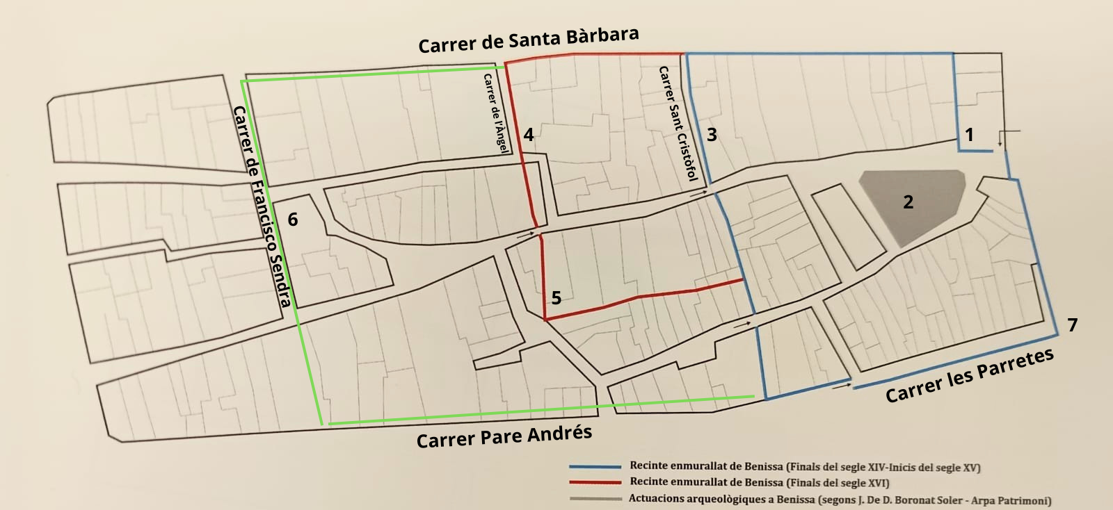
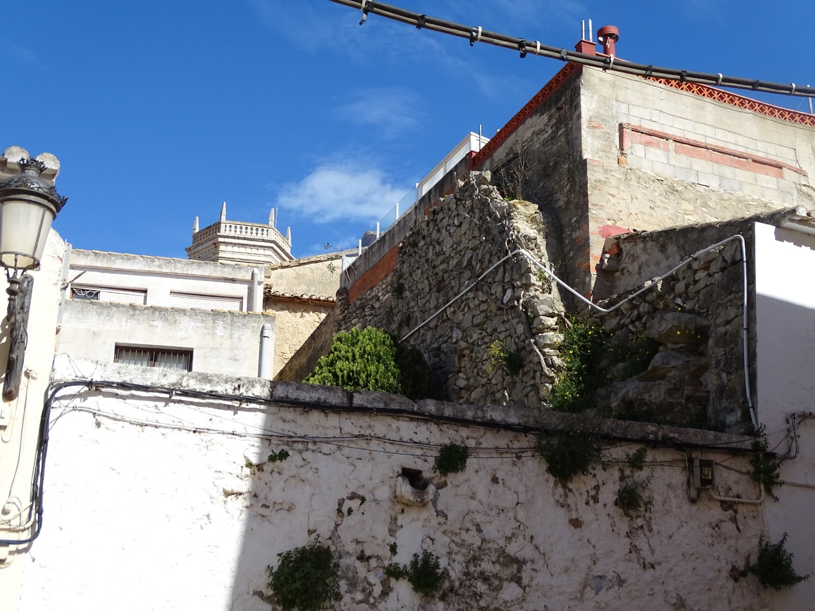
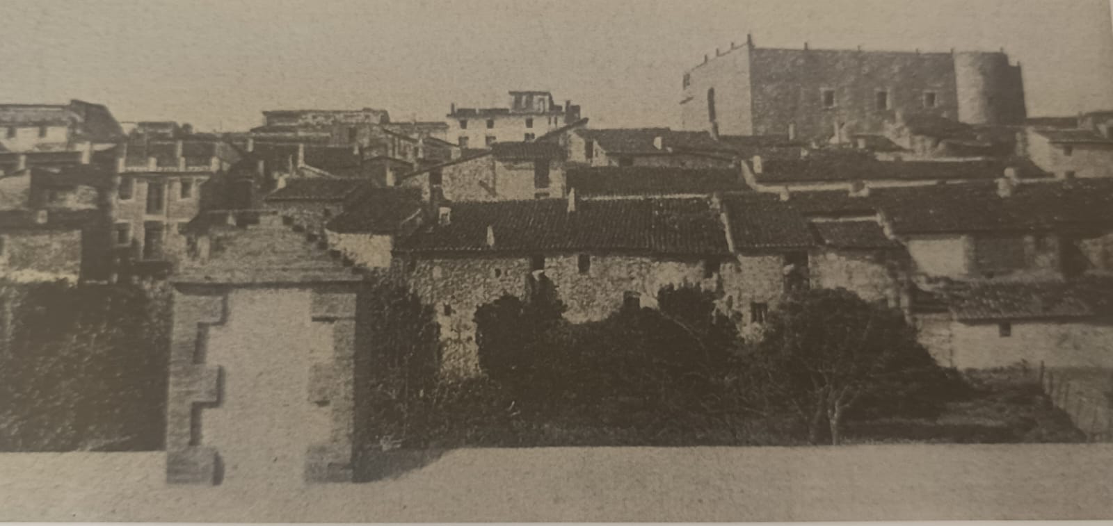
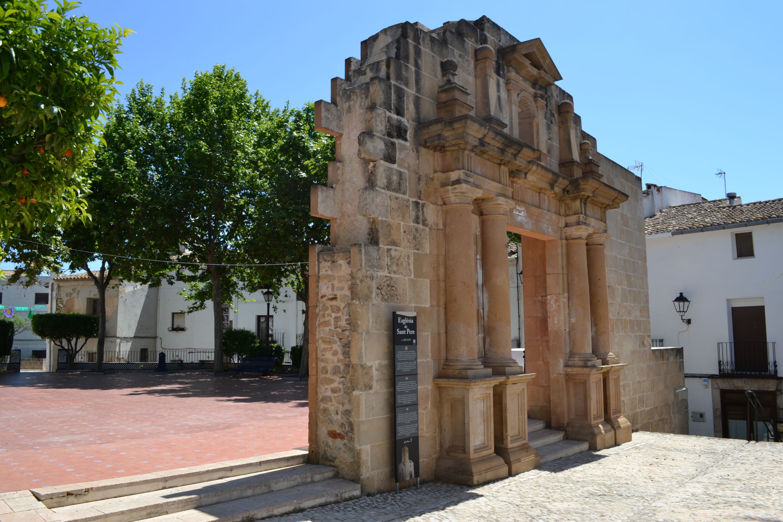
The oldest wall surrounded the fortified church of Sant Pere, which was located on the present-day Old Church Square (2). It was built in the 16th century to serve both religious and defensive purposes. Gradually, it fell into disuse, especially from 1929, when the Puríssima Xiqueta Cathedral was inaugurated. It was eventually demolished in the 1940s, as it had serious structural problems. Nearby is the Portal Square (1), which was one of the entrances to the enclosure.
We suggest you start the route from the Old Church Square, where you will see a representation of its portal on the site of the former church.
We will then walk up Sant Cristòfol Street, a narrow alleyway through which a section of the oldest wall used to run. We will emerge onto Santa Bàrbara Street, where some scholars argue that parts of the wall still survive. We will then head for Angel Street, which was the site of another section of the wall, though this one was newer, dating from a later extension. We will walk to the Batlle Houses, some old 16th-century manor houses that now house the library and the Salvador Sòria Contemporary Art Space. Visiting this building is very interesting, as we will find various historical vestiges from different eras. From the 11th century, we find some granaries that demonstrate the existence of a farmstead prior to the founding of the Christian town. It is also worth noting that we are now at number 5 on the map, where the rampart passed and formed a corner. At this point, there was a circular tower. There are no visible remains now, but the building recreates the location of the tower and the wall. The brown walls occupy the space of these two elements of the rampart.
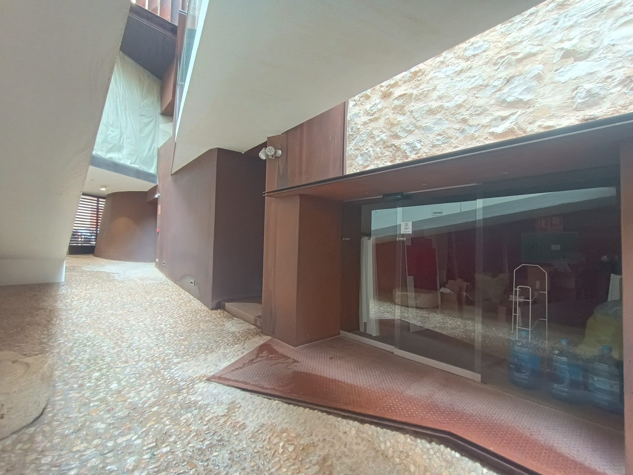
Once we have visited the building, we will move to Francisco Sendra Street, where we will find the old Town Hall, marked on the map with number 6. It was originally used as a warehouse on the upper floor and as a market and butchers' on the ground floor. The basement was a prison where the prisoners were probably Barbary pirates. Drawings of ships by these men are still preserved on the walls. This building now houses Social Services. Afterwards, we will stroll to Parretes Street, where we can see a wall integrated into the urban architecture that was also part of the walled enclosure.
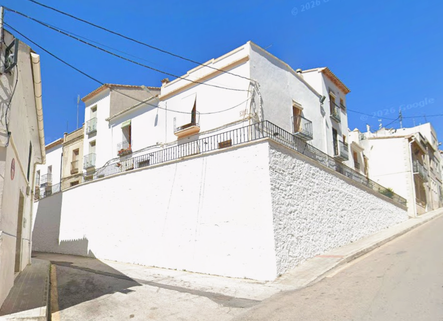
In conclusion, the remains of the medieval walls of the Marina Alta show us that history is not always confined to a museum; it is often in plain sight, integrated into our everyday landscape without most people being aware of it. It is true that, unfortunately, the passage of time has meant that many of these vestiges have not been preserved. It is precisely for this reason that every stretch that still stands is an invaluable treasure, inviting us to look at our surroundings with fresh eyes and to protect what heritage we have left.
Bibliografia
Ahuir, J. A. (2011, 23 de diciembre). Dénia: Una ruta per la seva història, el seu patrimoni i la seua gent. Història de Dénia: Història, Art i Patrimoni de Dénia i la Marina Alta.
Almerich, J. M. (2011). Paisatges fortificats: Torres, muralles i castells a les terres valencianes. Institut d'Estudis Comarcals de la Marina Alta (IECMA).
Banyuls i Pérez, A. (2009). Renaixement a l'ombra de la contrareforma: Renovació urbana i arquitectura a la Marina Alta (1535-1632). En J. M. Almela y Arxiu Municipal de Pego (Coords.), III Jornades d'estudis 'Carmel Giner Bolufer' de Pego i Les Valls. Actes 2008. Ajuntament de Pego.
Cardona i Ivars, J. J. (1971). Las fortificaciones de Benissa en el s. XVI. En Llibre de festes de Benissa 1971.
Guinot, E., Torró, J., y Martí, J. (2004). Carta de poblament de Pego, 1279. Ajuntament de Pego.
Ivars Cervera, J., y Buigues Vila, J. (1999). El patrimoni artístico-monumental de Teulada (2.ª ed.). Ajuntament de Teulada.
Menéndez Fueyo, J. L. (2020). El caballero de Ifach: El ocaso de la ciudad medieval. Museo Arqueológico de Alicante (MARQ).
Museo Arqueológico de Alicante. (2009). Calp, arqueología y museo: Ciclo Museos Municipales en el MARQ. MARQ.
*This experience is designed to be done in six stages, corresponding to six different days. We suggest some routes, but each person can adapt the experience to their abilities, physical stamina and interests. If you would like more information or places to visit in each town, you can visit the Descobrim la Marina Alta website and adapt the experience to your own tastes with your rucksack.
AND MORE. At the table and in bed at the first cry.
 Where to buy |  where to eat |
 where to sleep |  Activities and others |
Translated with DeepL.com (free version)