This March, the MACMA team thought it would be worth taking advantage of the start of spring and the longer days to explore some of these places. We have designed an experience suitable for the whole family and, although it is designed to be done in three days, it is completely adaptable to your needs and interests.
Whether you decide to do the two itineraries that we propose, or if you adapt them to your own pace, the certainty of traveling through natural landscapes that were the scene of the first human settlements will turn your route into a complete cultural and tourist experience.
A LITTLE HISTORY. We know where we come from to decide where we are going.
Traditionally, prehistory, as a period, has been excluded from first cycle, primary or elementary education programs and has received less attention within the pages of textbooks at higher educational levels.
That is why, despite being an exciting period, it remains almost unknown and from time to time we need to shed light on it.
In the Marina Alta, geomorphology and orography, with three well-differentiated zones (alluvial plains, transitional spaces and mountainous domains) have been crucial in determining the evolution of the first population settlements in the region.
The fertile soils, derived from the sedimentation of materials from the Triassic, Jurassic and Cretaceous periods, together with the alluvial deposits of the Quaternary, favored the emergence of small subunits linked to river courses, and increased communications between them. In short, the orography determines human movements, with an increase in places of refuge and surveillance posts.
The first documented settlements in the Marina Alta date from the Upper Paleolithic (40,000-10,000 BC), when the Neanderthal began to disappear and Homo sapiens expanded. The first abstract thought appears and is reflected in the parietal art typical of this period. The Cova del Comte de Pedreguer , with a human presence already confirmed around 24,000 BC, or the Cova de Reinós in La Vall de Laguar are two examples.
From the Gravettian period would be the Cova de les Cendres in Teulada and a little later, from the Solutrian period, the Tossal de la Roca in the Vall d'Alcalà , the Cova del Moro in the Poble Nou de Benitatxell , the Cova Ampla del Montgó or La Cova de les Calaveres in Benidoleig. From the Magdalenian we have dated the Cova Fosca , in La Vall d'Ebo , and although it can only be visited by groups of prepared speleologists you can discover the Ethnological Museum and Rock Art Interpretation Center of the municipality.
During the Epipaleolithic (or Mesolithic) we once again see how climate changes cause changes in the landscape and consequently in human movements and culture. The flooding of coastal areas withdraws the population towards the highlands, generating new settlements such as the Cova del Bolumini in the town of Beniarbeig or the Cova del Randero in Pedreguer , among others.
Therefore, when the Neolithic period began, around 8000 BC, the Marina Alta already had a good number of human settlements, 21 in total according to the latest studies.
In most of these sites, samples of wall art have been found, of which we find three distinct styles:
- Levantine art, with figures with little volume that represent scenes of hunting or vegetable gathering.
- Macro-schematic art, with more schematic figures that are usually represented with their arms raised. The Sanctuary of Petracos , in Castell de Castells, is a very important example of this style in our region, but we also find others in the Vall de Gallinera or the barranc de l'Infern , in the Vall de Laguar , very important because they confirm the existence of religious cults and abstract thought among these early settlers.
- Finally, schematic art with anthropomorphic figures representing idols, as well as astral or geometric figures, are also examples of this symbolic thinking. Although we have fewer identified locations, we can observe this style in the Cova Migdia in Xàbia or in the cave paintings of Benialí and Benirrama .
Therefore, the entire region, but especially the inner half, offers numerous sites of great interest, which show us the relationship between river traffic and humans and how geography conditions the development of societies.
From later periods, paradoxically, we have fewer vestiges, since the settlements were formed as open-air villages, which have not been preserved. In any case, we do find numerous burial caves, used as tombs or pantheons, where fairly developed objects and trousseau pieces have appeared and which can be classified into three periods:
- Chalcolithic or bell-shaped, with mostly ceramic utensils, although some metal objects begin to be used. It is a time of demographic increase that entails the need to cultivate to obtain food, the plow appears and excavated silos are also built to store grain. At the end of this period we find metal funerary goods and some small ivory objects.
- Valencian Bronze Age, a period in which populations also settled in mountain areas, at more than 1000 meters of altitude, occupying the entire Marina Alta. New vestiges of civilization appear, linked to constructions made with masonry.
- Iron or final bronze, during this period we witness the abandonment of some settlements to concentrate in a smaller number of nuclei. Metallurgy is consolidated and we find casting molds to make objects. We also note the beginning of commercial contacts with civilizations such as Phoenicia and other Mediterranean cultures.
PROPOSED DAYS. Step by step we are making our way.
The experience takes place over three days, during which you will be able to visit different sites and caves that will allow you to interpret the traces that men and women of prehistory left in our region and understand how their societies evolved between the Paleolithic and Neolithic periods.
We will go from the coast to the interior, both on the first route through the south of the region ( Benissa - Xaló - Castell de Castells ) and on the second and third days of the route, when you will discover some caves and sites in the north of the Marina Alta ( Dénia, El Verger, Beniarbeig and Benidoleig , on the one hand, and La Vall de Gallinera, with a visit to the cave paintings of Benialí and Beniarrama , on the other).
Day 1. Benissa - Xaló - Castell de Castells Castle
The Abric de Pinos , in Benissa, will be the starting point. It is a set of cave paintings declared a World Heritage Site by UNESCO in 1998 and which includes one of the first female figures in Valencian cave art, with an antiquity of around 6000 years.
Follow your route for about 15 km, between vineyards and fields until you reach the Cova del Mançano (Xaló), an ideal place to observe fairly developed cave paintings, with naturalistic hunting scenes, characteristic of Levantine wall art.
 Mançano Cave in Xaló
 We recommend that you do not leave Xaló without visiting the Cova de les Meravelles with vestiges of continuous use from the Neolithic to the Middle Ages. Geologically, it is also relevant thanks to its stalactites and stalagmites.
In addition, if you go there on a Saturday, you can stop and take a stroll through the flea market of Xaló and the Earth Market , where you can buy local products from km 0, without intermediaries.
You will have to take the car to reach the next point on our route, we will take the CV -720 and at a distance of about 21 km you will find the town of Castell de Castells , where we recommend you visit the Ethnological Museum of Macrosquematic Art of Petracos .
Once you have visited the museum, from there you can approach the Sanctuary of Pla de Petracos, a site of macro-schematic art, declared a Site of Cultural Interest and World Heritage Site and of great relevance since, unlike other places, it was not used solely as a home or shelter, but was a sanctuary, also dedicated to beliefs and worship.
To get there you can go in your vehicle or by hiking. It is a route of about 4 hours and medium difficulty that offers many points of interest along its route:
- Museum of Macroschematic Art (exit).
- Xorro fountain and washhouse.
- Irrigation pond
- Horta Bridge.
- Xancosa Mill.
- Gomis Mill.
- Espetla Fountain.
- Sanctuary of Plan de Petracos (arrival).
Depending on the day of the week you take your route and the hours of daylight, you can visit the sanctuary first and then the Museum, which is open Friday and Saturday from 11:00 a.m. to 1:30 p.m. and from 5:00 p.m. to 7:30 p.m. and on Sundays from 11:00 a.m. to 1:30 p.m.
In any case, a stop at one of the bars and restaurants in Castell de Castells is always a good idea, whether to regain strength after the excursion or to have a light breakfast before starting it.
Day 2. Dénia - El Verger - Beniarbeig - Benidoleig
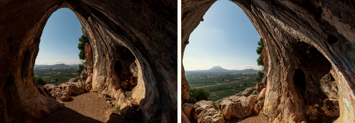
This day begins by visiting the Cova de la Catxupa , in the municipality of Dénia. It is a natural amphitheater where you can see Neolithic cave paintings, more than 6,000 years old, in a good state of preservation.
Although you can see some of the cave paintings from the entrance to the fence that protects the site, it is highly recommended that you arrange a guided tour with the Ethnological Museum of Dénia , by calling 966 420 260.
The Cova de la Catxupa is located near the town of Gata de Gorgos where the tradition of making tin cans, an artisanal craft, is still maintained. As you cross the town, on your way to the next stop, you will see the handcrafted products on display and perhaps you will take home a basket, a basket or a rug.
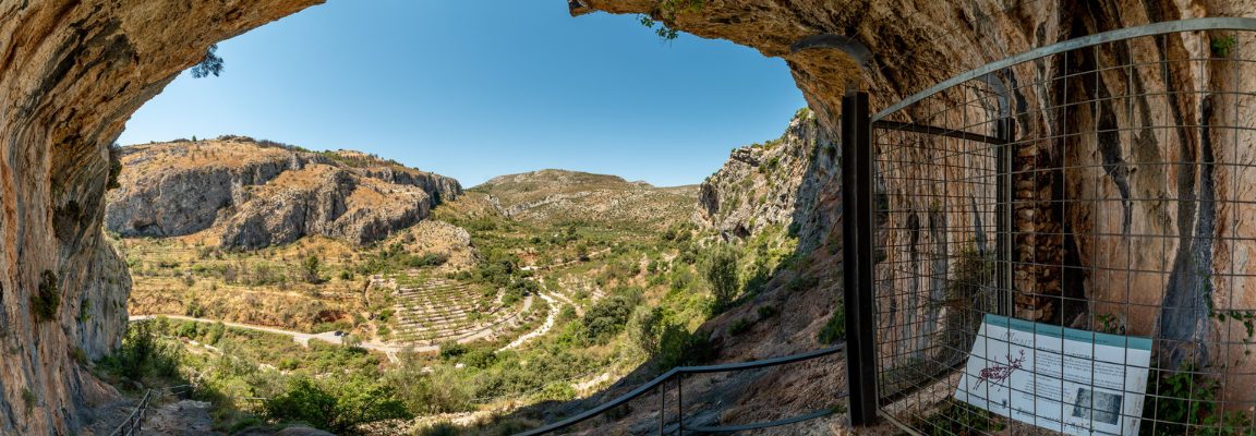
Then head along the N-332 to the town of El Verger. The Cova Fosca , nestled in the heart of the Serra de Segària , was used during prehistoric times as a dwelling and as a burial cave, which is why a large number of ceramics and trousseau pieces have been found.
 The Dark Cave of the Verger
The Bolumini Cave in Beniarbeig , just 4 km and 10 minutes by car, is the next landmark on the way. With manifestations related to the spiritual world of our ancestors, scholars believe that it could have been a sanctuary during the Early Bronze Age.
A short distance from Beniarbeig is Benidoleig , where you can visit one of the caves best suited to family tourism, the Cova de les Calaveres , with more than 900 meters of route open to the public, this site has provided human and animal remains, as well as stone tools. The distance between the two sites is less than 8 km, along the CV 731.
As you can see, these last three settlements are within walking distance of each other, which shows how a social fabric was beginning to form and how some groups undoubtedly related to others.
After these visits you may want to stop to rest and have lunch at any of the establishments in the area.
You need to gather strength before heading into the Gallinera Valley the next day, where we propose three visits.
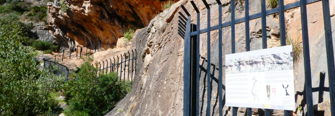
Day 3. The Gallinera Valley (Gallinera Valley Interpretation Center, Benialí, Benirrama)
It is advisable to get up early to arrive early in Benialí , the municipality where the Vall de Gallinera town hall is located and where you can visit the Vall de Gallinera Interpretation Center , which will be the starting point of the second part of the itinerary, the Benialí cave paintings route and the Benirrama cave paintings route , two rocky shelters that are a short distance from each other and are worth visiting together.
The entire route will take you about 4:40 hours with a difference in altitude of about 400 meters but without any other complications, which makes it suitable for all types of hikers. You will find the necessary information about this circular route in our wikiloc Rock Art Route of the Vall de Gallinera
This route connects the Interpretation Center and the two rock art complexes, with a route of about ten kilometers and also combines landscape, environment, history and culture. The itinerary has as its starting point the urban center of Benialí, in whose Town Hall the Interpretation Center is located.
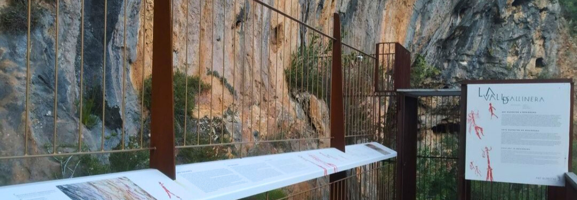 Exhibition of Benirrama cave paintings
If you are an early bird or, depending on the time of year, there are enough hours of daylight, you can adapt the route to your convenience, concentrating all the visits in two days. If you decide to spend the night along the way, there is a good network of inns, hostels and rural hotels throughout the interior of the region, you can consult it from our website Where to sleep
We hope that this route has brought you closer to the prehistory of the Marina Alta in a simple and educational way and that you have enjoyed the path in contact with nature, between the sea and the beautiful mountains of our region. You will find more information about each place in the link that accompanies the description and on the website Descobrim la Marina Alta .